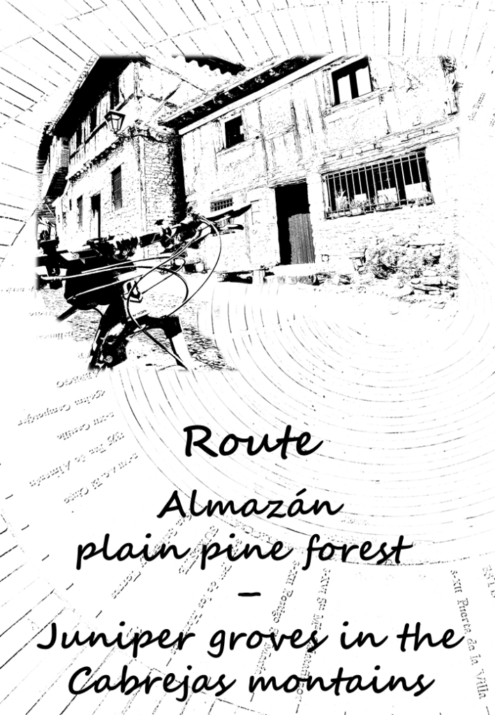


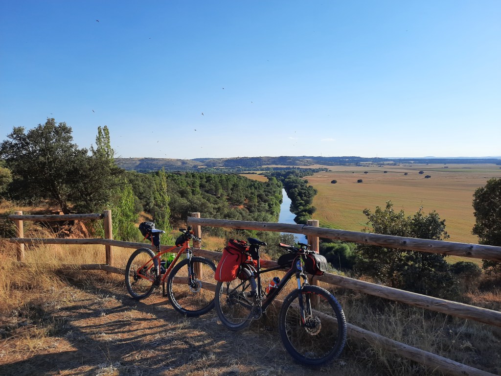
On this route we will connect and discover two very different natural areas in the province of Soria.
The first one, the area known as “Pinares llanos,” is an extensive mantle of resin pines north of Almazán. Until the 70s of the past century, the resin extraction and processing, was an important economic resource in this region, also rich in mycological resources. Since few years ago, the resin activity, has been recovered and it is proving to be helpful in fighting against the depopulation of this province, which has the lowest population density in all Spain.
The second one, the juniper groves of the Sierra de Cabrejas mountains, a natural space of about 33,000 hectares and included in the Natura 2000 Network. In this area, we can find towns with an authentic popular architecture, such as La Cuenca or Calatañazor, as well as incredible places like the spring of La Fuentona, or the ancient junipers of the Sabinar de Calatañazor.
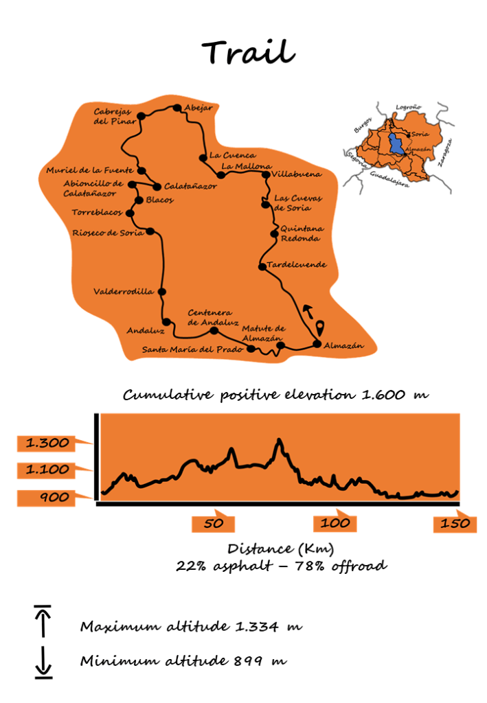
With a distance of about 150Km, mainly off-road, you can consider a two or three-day plan, either by MTB or gravel.
Along the way you can find different types of tourist accommodation, and also shelters, which are adapted for cyclists who are more adventurous or for those who prefer an easier logistic.
Almazán


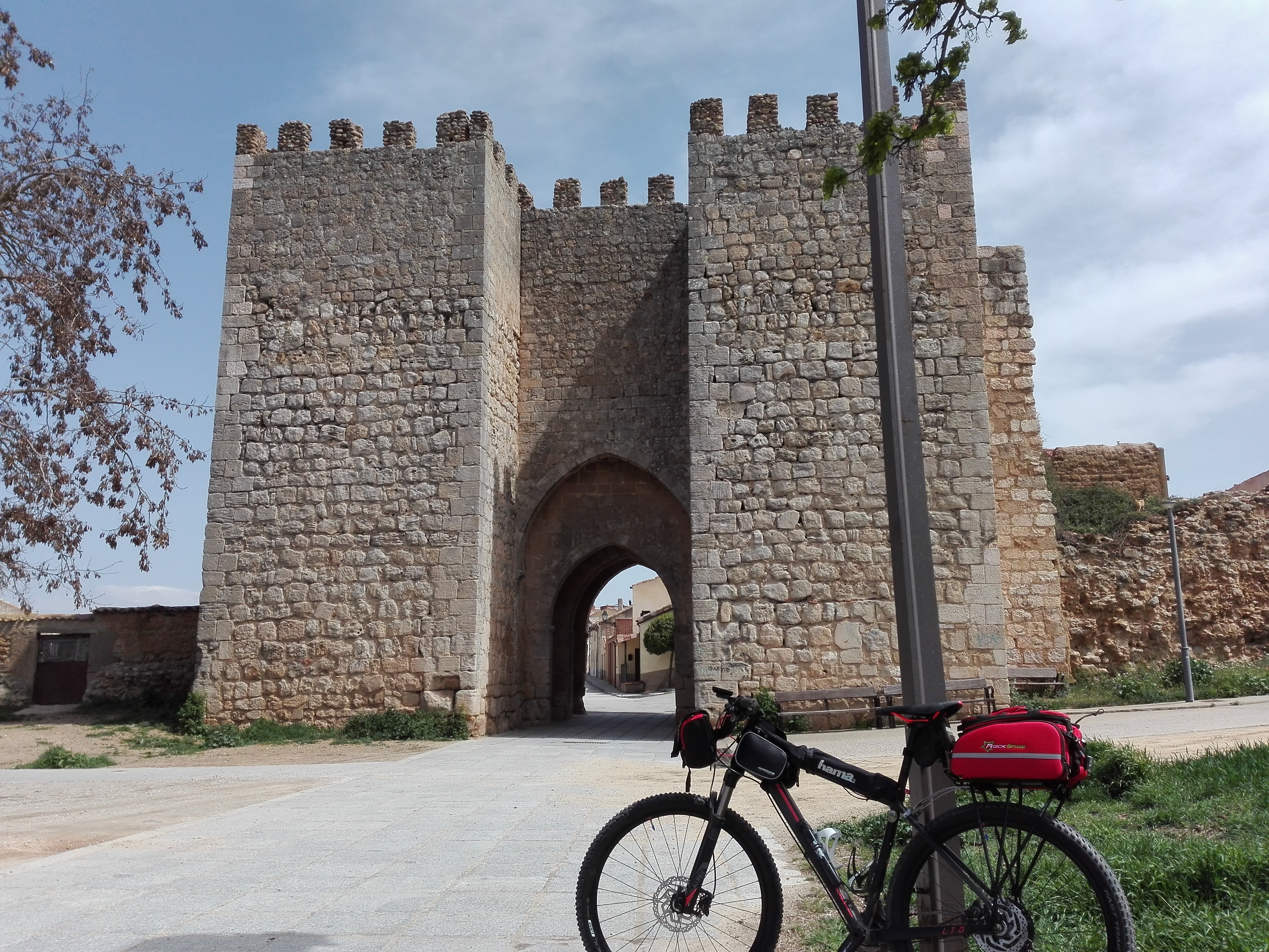


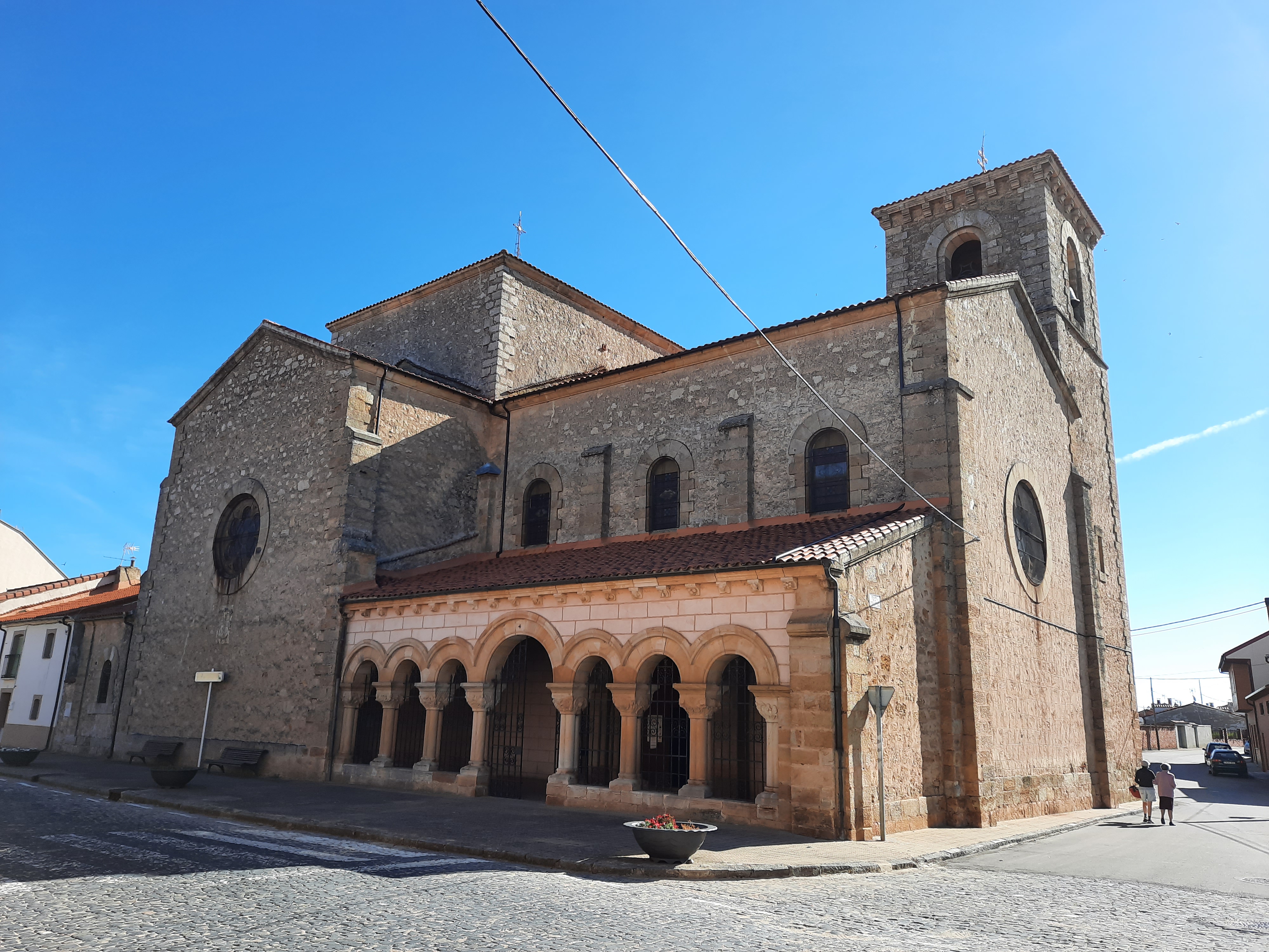
Km 0 of the route is located in the Plaza Mayor of Almazán, whose name, of Arabic origin, means «the fortified“.
Its founding is attributed to Abderramán III, way back in 1,088 and to Alfonso I «The Battler» his definite reconquest for Christians in 1,128.
Court of the kingdom of Castile, on several occasions, Almazán’s golden age, began in the sixteenth century, under the strong influence of the family Hurtado de Mendoza.
Its Main Square, reformed in 2011, forms a beautiful set, where a good part of the Villa´s charms can be found.
It preserves the typical structures of a Castilian square, with its balconies and porches.
We can also see part of the ancient wall, the shutter of San Miguel, with spectacular views of the Duero, and the Villa Gate, which gives access to the square from the north, and over the that rests the clock tower.
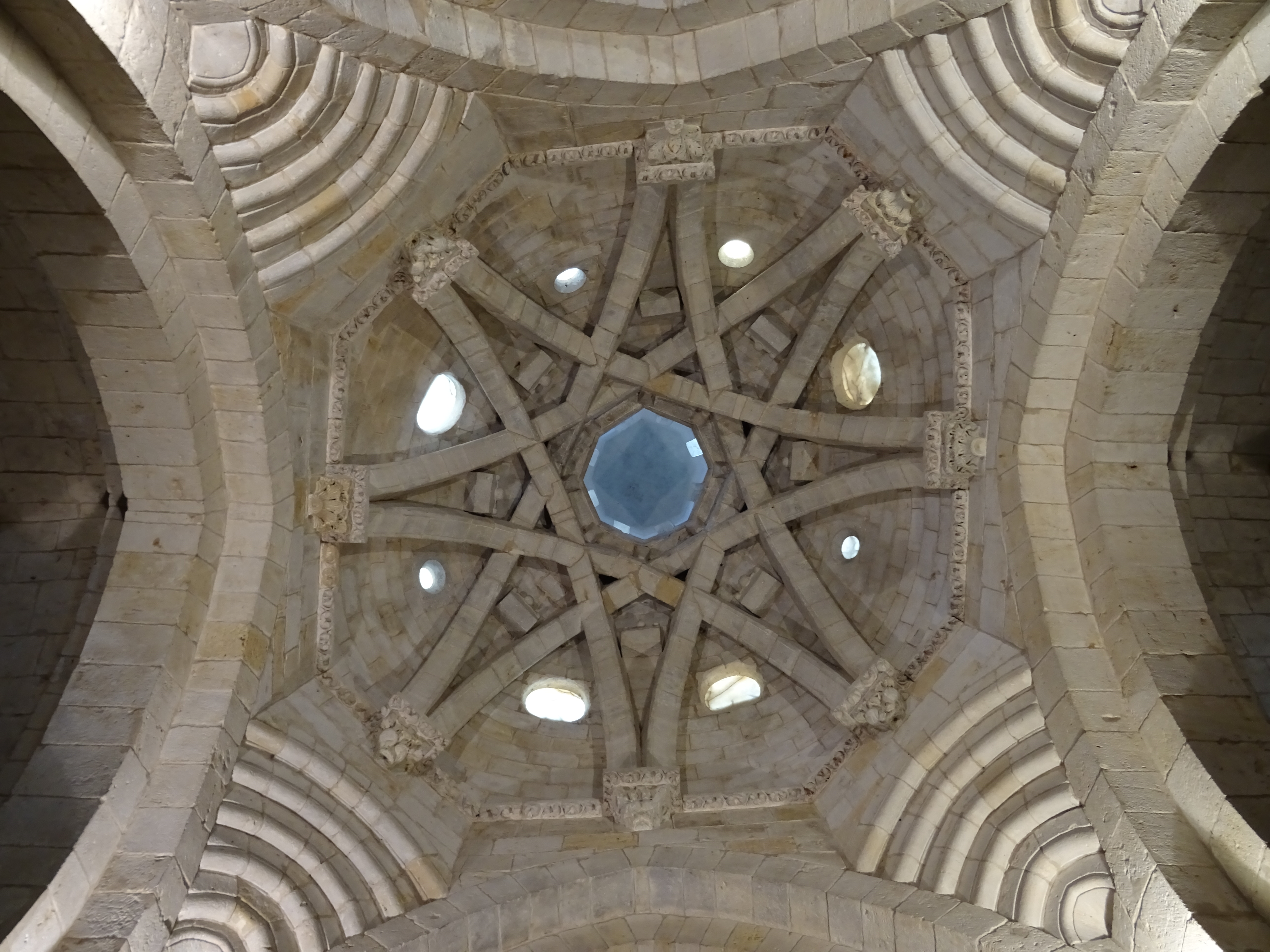
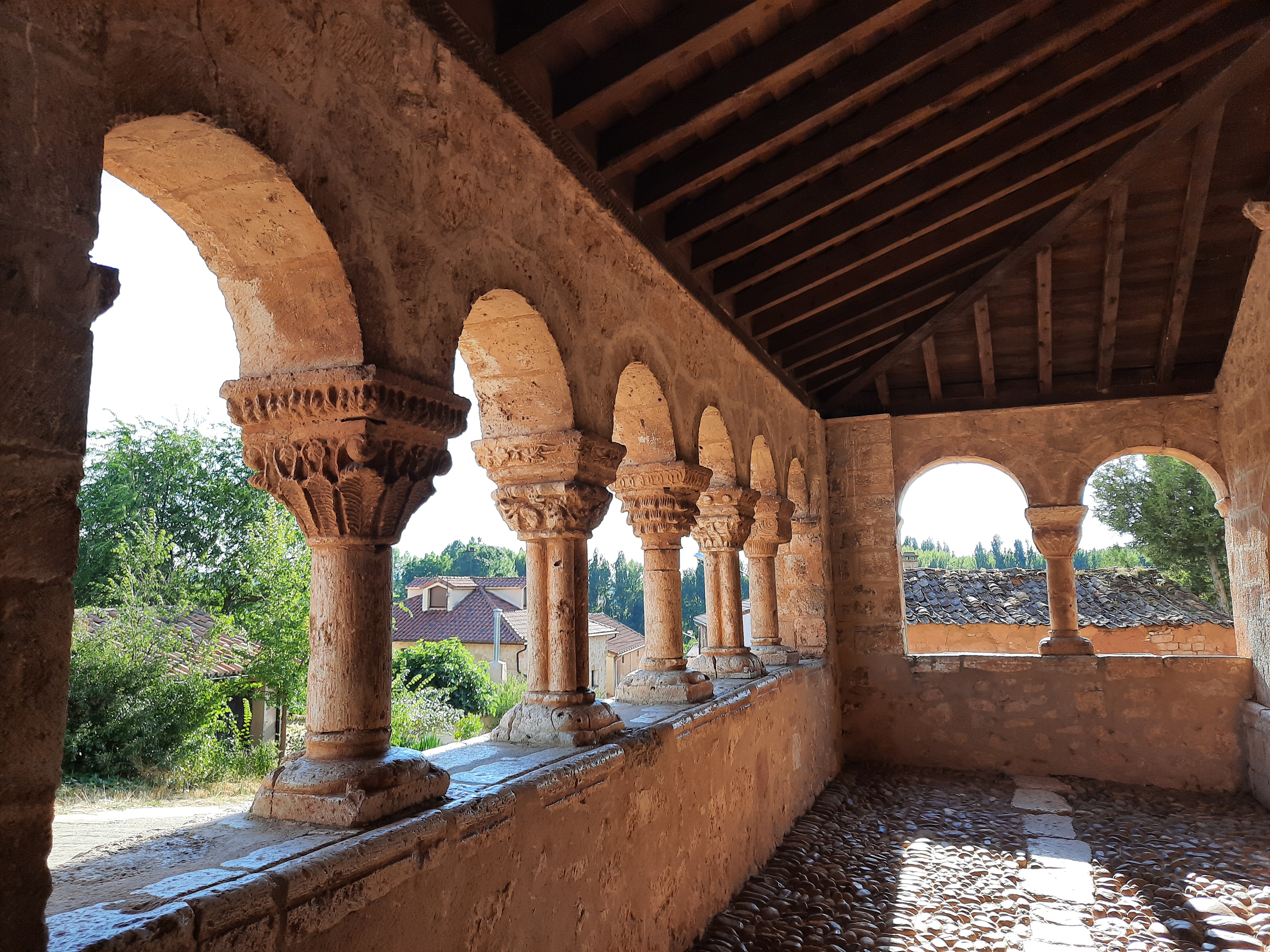
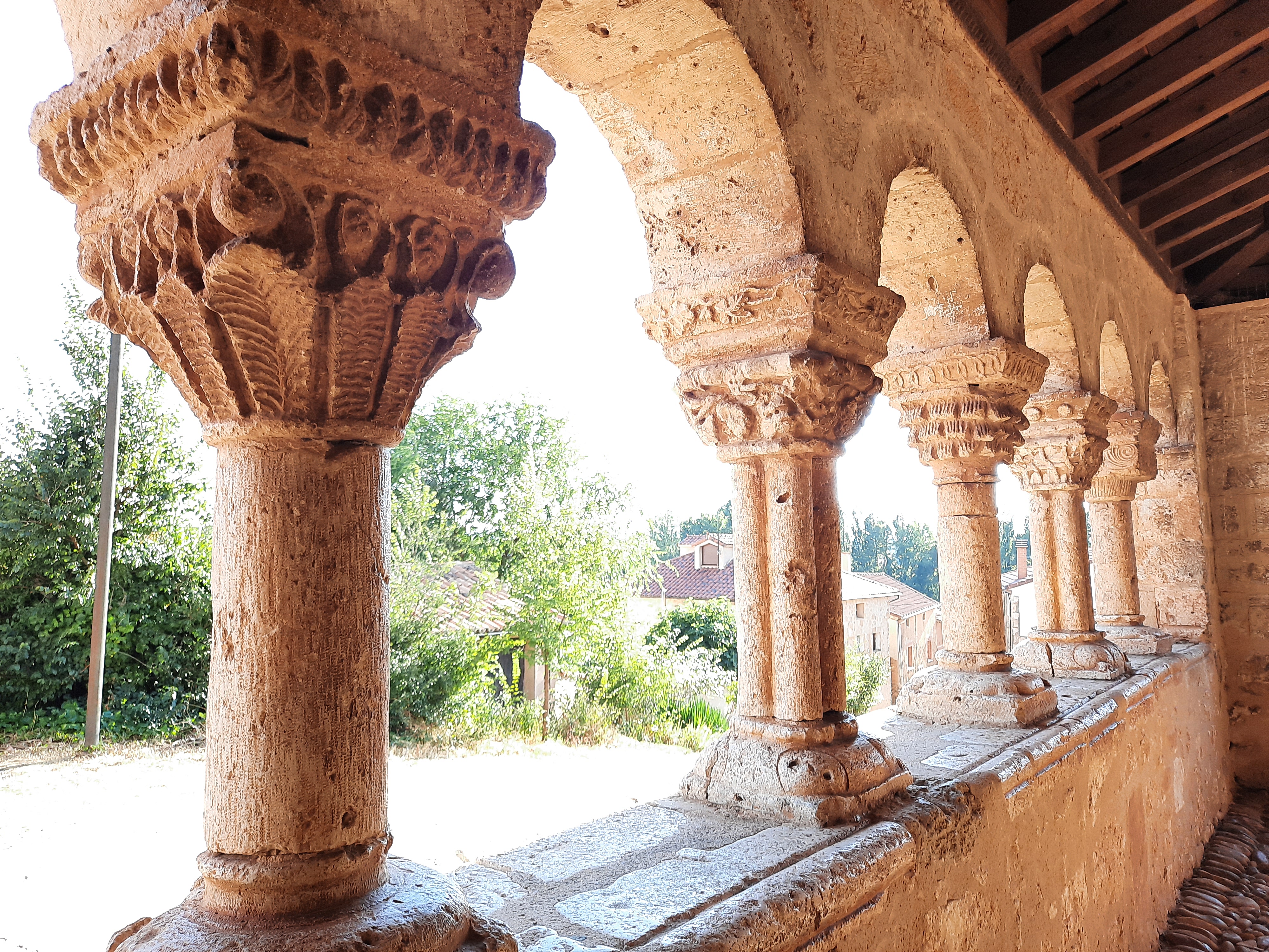
St. Michael’s Church, one of the jewels of the Romanesque province and the Palace of the Hurtado de Mendoza family, where we can also find the tourist office, complete the set.
Walking through the rest of the old town, which still conserves its medieval physiognomy, we can walk through its wall and find two of its access doors, the Blacksmiths’Gate and the Market Gate very well preserved, in addition to other buildings of interest.
In front of the Main Square, on the other side of the Duero, we can enjoy a pleasant walk by La Arboleda Park, Almazán´s great green area, also with very nice views towards its historical centre.
We leave the Main Square on Palacio Street, to the Rollo de las Monjas, at the end of the historical Centre, then towards the right, down the Ronda del Duero, along the wall to the bridge on which we will cross the River Duero.
We continue along Avenida de Soria, crossing the railroad track and arriving at a former furniture factory, we cross to the left in search of the GR 86 pathway.
We pass alongside the town of Fuentelcarro and we go deep through the vast pine forest that covers this whole area.
Quintana Redonda

We arrive at Tardelcuende, and we continue to Quintana Redonda, two of the largest villages in this area. In Quintana Redonda, we can see the Romanesque church of Nuestra Señora de la Asunción and the Gregory Gonzalez Palace, and we can also visit the CeramicTheme Centre.
Las Cuevas de Soria, Inodejo

From here to Las Cuevas de Soria, first by road and then on dirt roads , to pass through the archaeological site and museum of the Roman villa of La Dehesa.
Declared as a cultural interest. It was one of the first Roman villas discovered in Spain. First excavations took place in 1928.
The villa can be visited through walkways, from which we can see the different rooms that form it and the mosaics that decorate them.
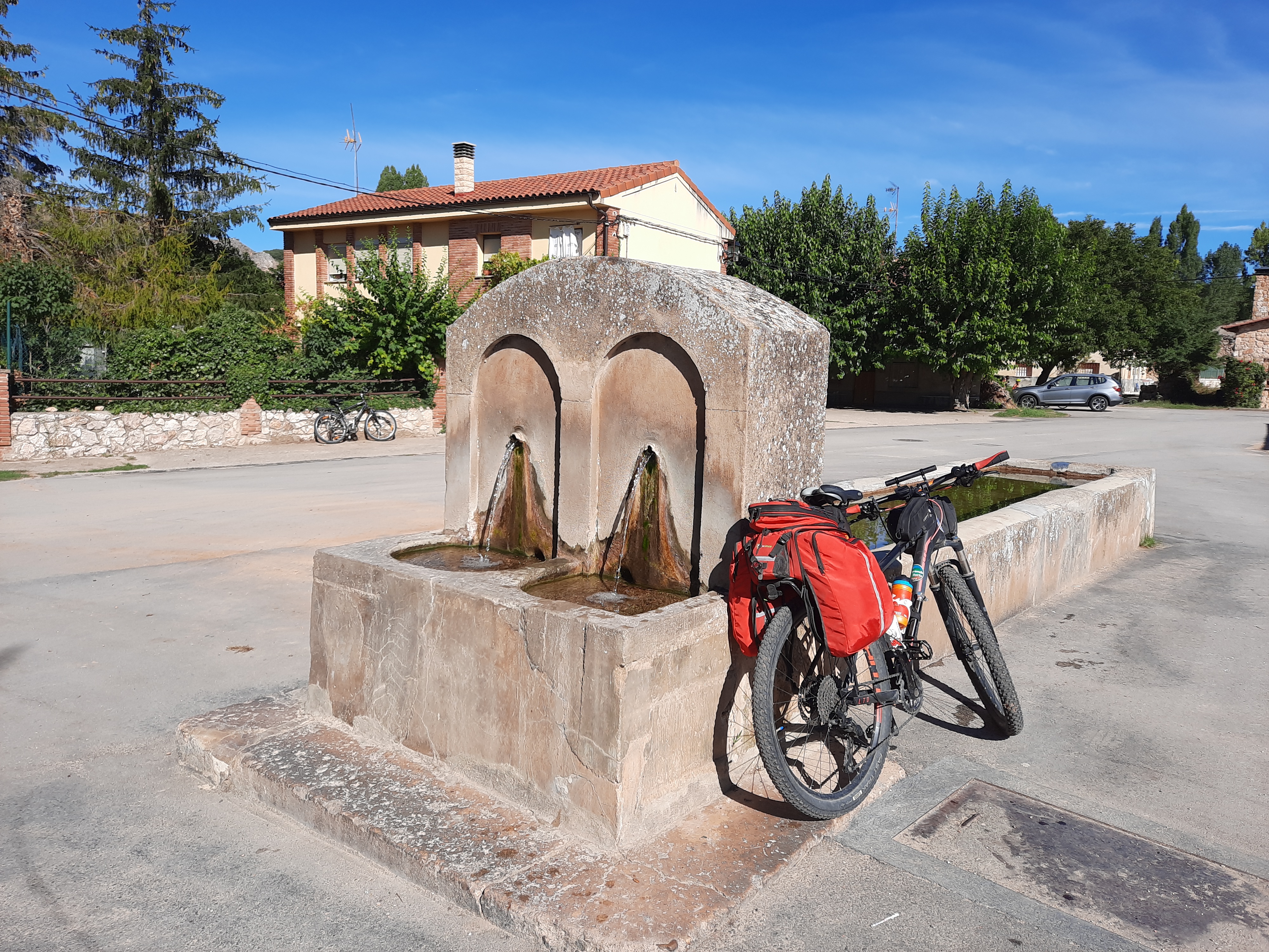
Once in Las Cuevas de Soria, a small park next to the fountain of the village, behind the pelota court, can be a good place for a little break.
If we look for the north exit of the village, we will arrive at a path that takes us to a small canyon that forms the Izana River, cutting the Sierra de Inodejo at its eastern end.
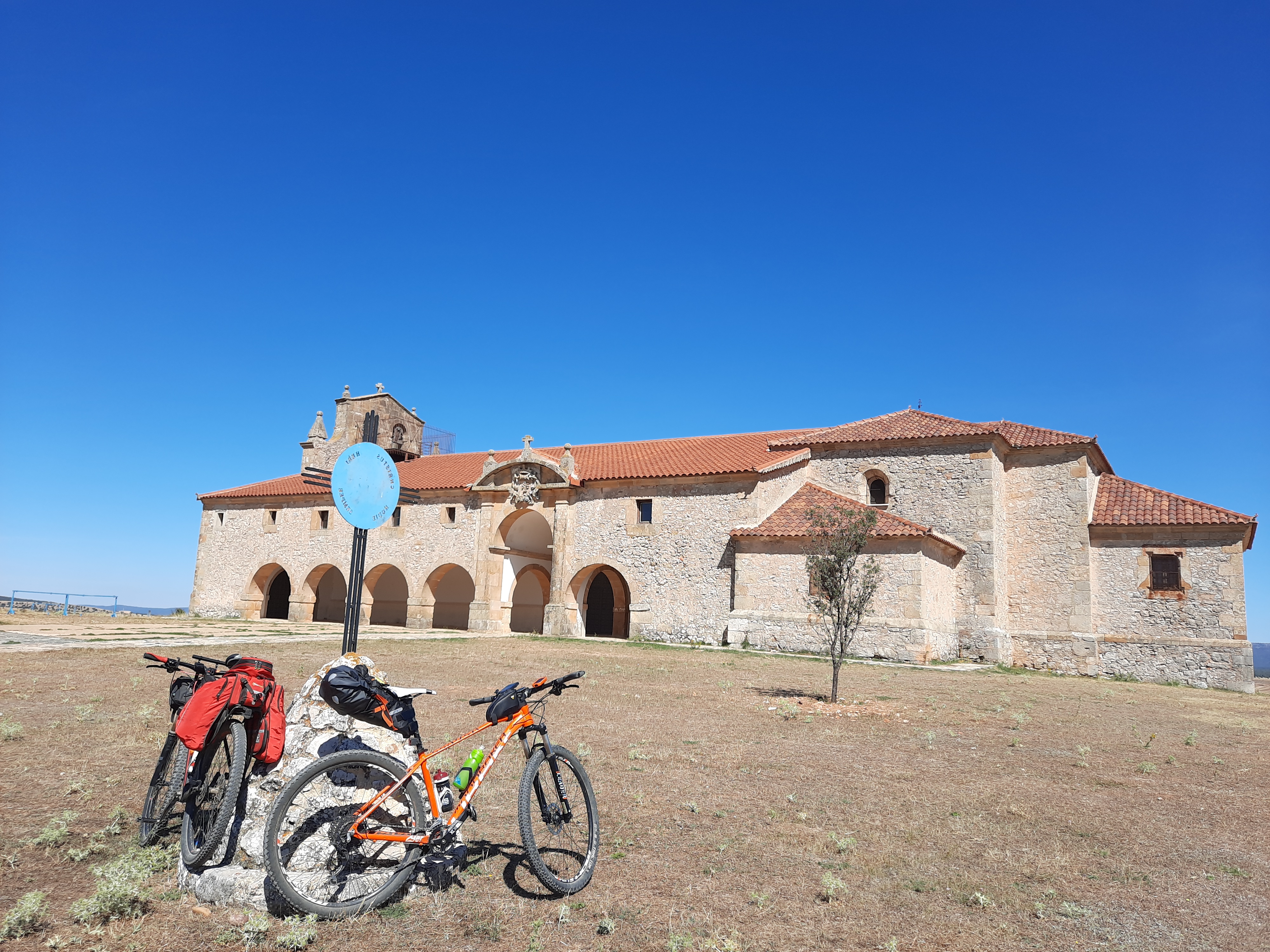
We go back towards the village and now we go out to the West. We cross the Sierra de Inodejo and its holm oaks, along a good trail, that takes us uphill to the Hermitage of Nuestra Señora De Inodejo. From here, if we look to the north, we can see the groves of the Sierra de Cabrejas and behind that the Urbión peaks.
We continue on a paved road to Las Fraguas, and unpaved to La Mallona. Again along a paved road, calm and with good asphalt, we pass underneath the Duero Highway, to reach la Cuenca, going through the first groves.
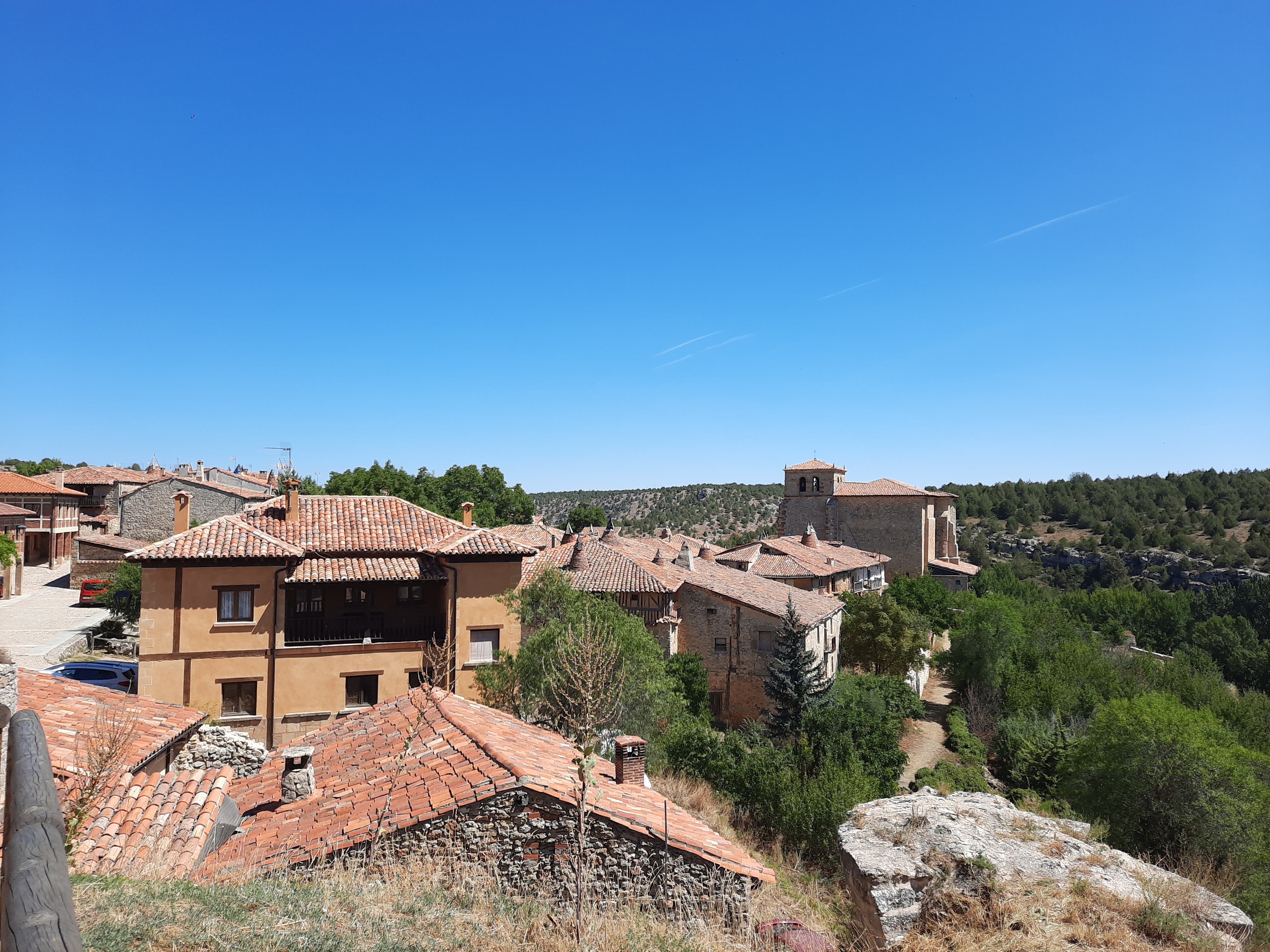
La Cuenca
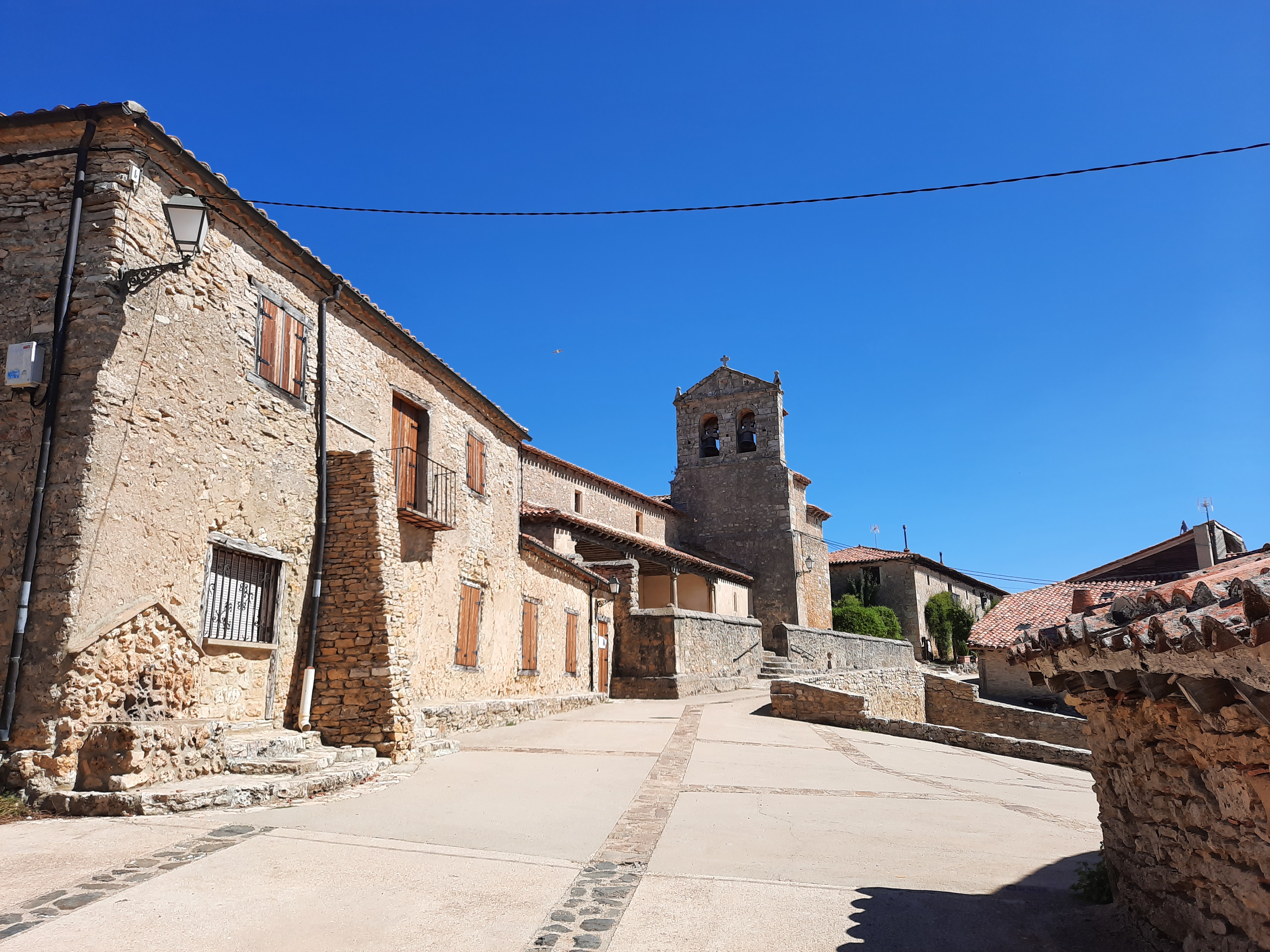
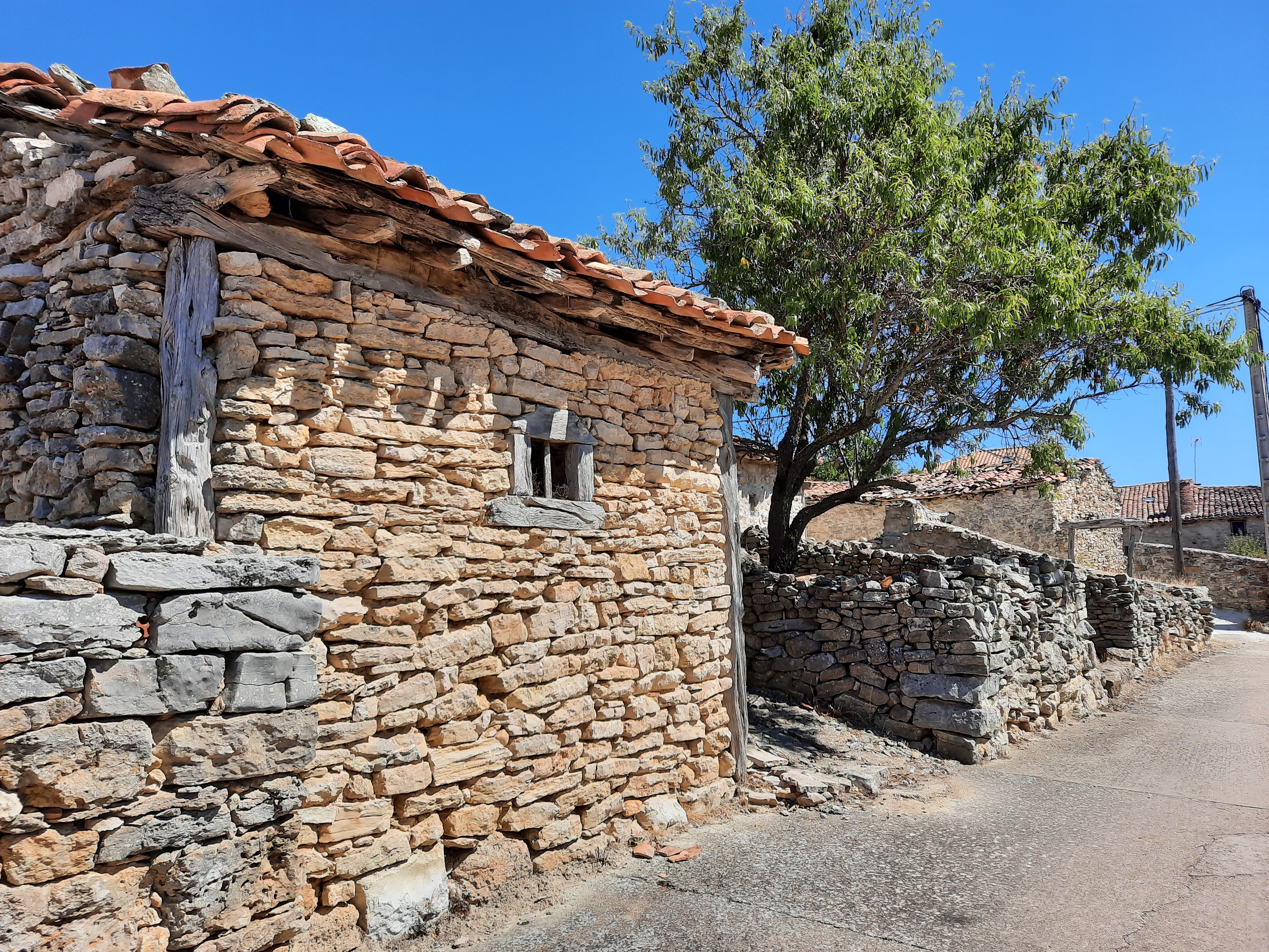
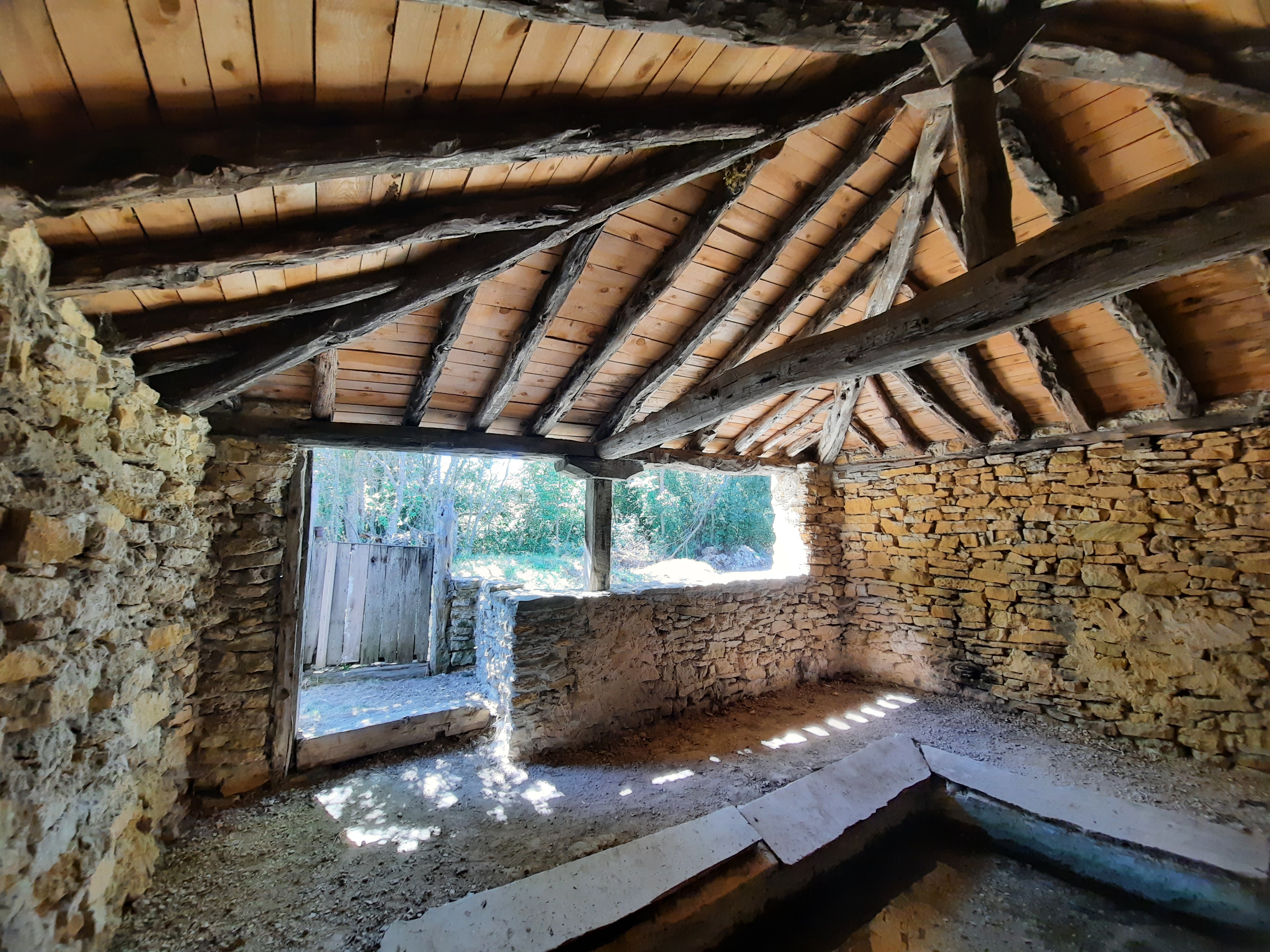
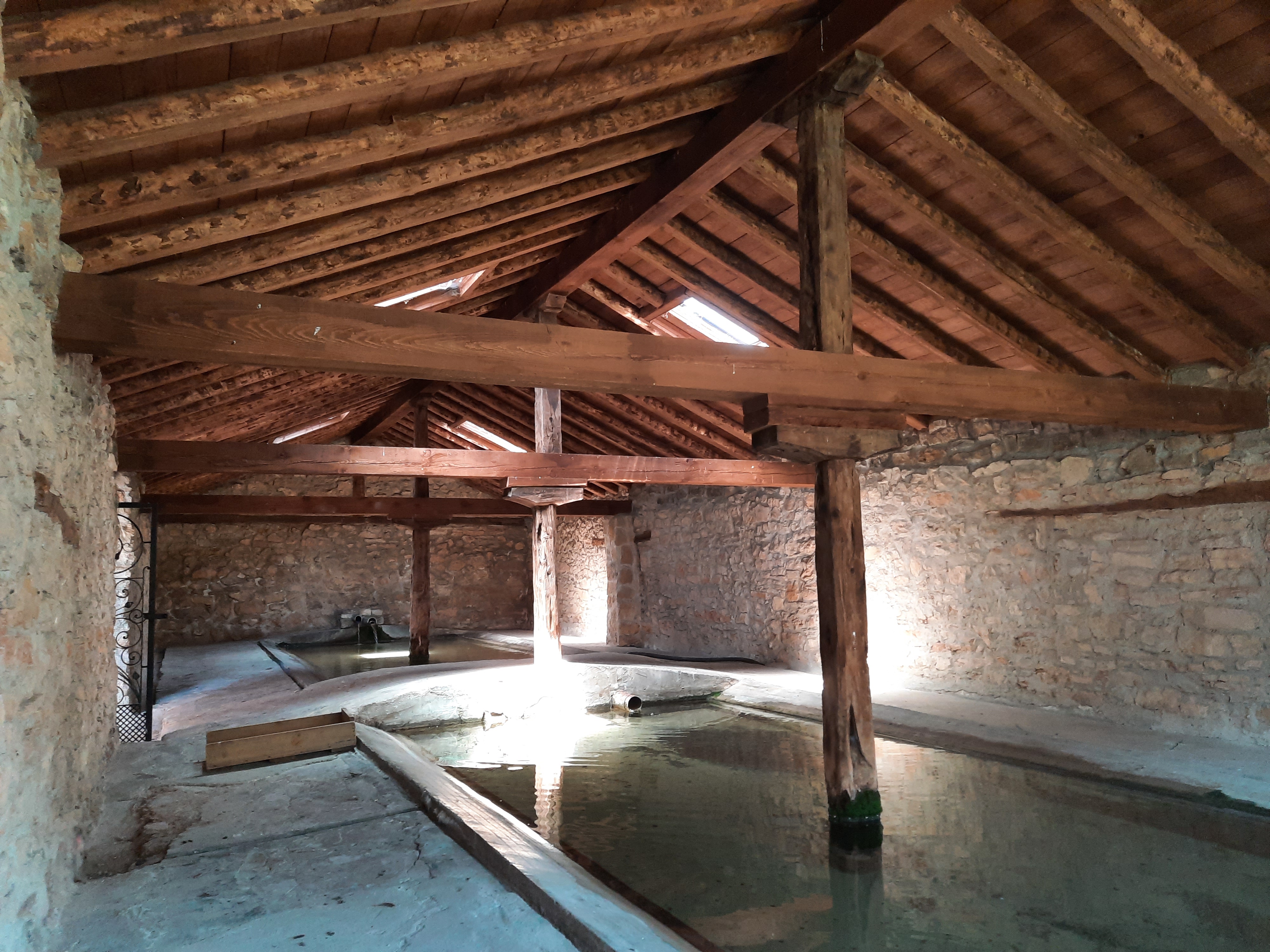
La Cuenca, declared an ethnological site, is an architectural pearl where time stood still many years ago. The houses and the rest of the buildings, walls, public laundry room… are kept in very good condition, respecting the original materials, stone, juniper wood and mud. And a lovely aroma of juniper wood permeates the whole village.
The laundry area, on the other side of the stream at the entrance of the village, can be a good option for another break.
We are now in the heart of Sierra de Cabrejas and cycling towards Abejar. Once again we go uphill. In this part, good tracks alternate with dirt roads. These landscapes, surrounded by juniper trees are fantastic.
We have arrived at the top of the Sierra de Cabrejas and if we continue along the track, we´ll soon reach the road connecting Abejar and La Venta Nueva. From there it’s all downhill to Abejar.
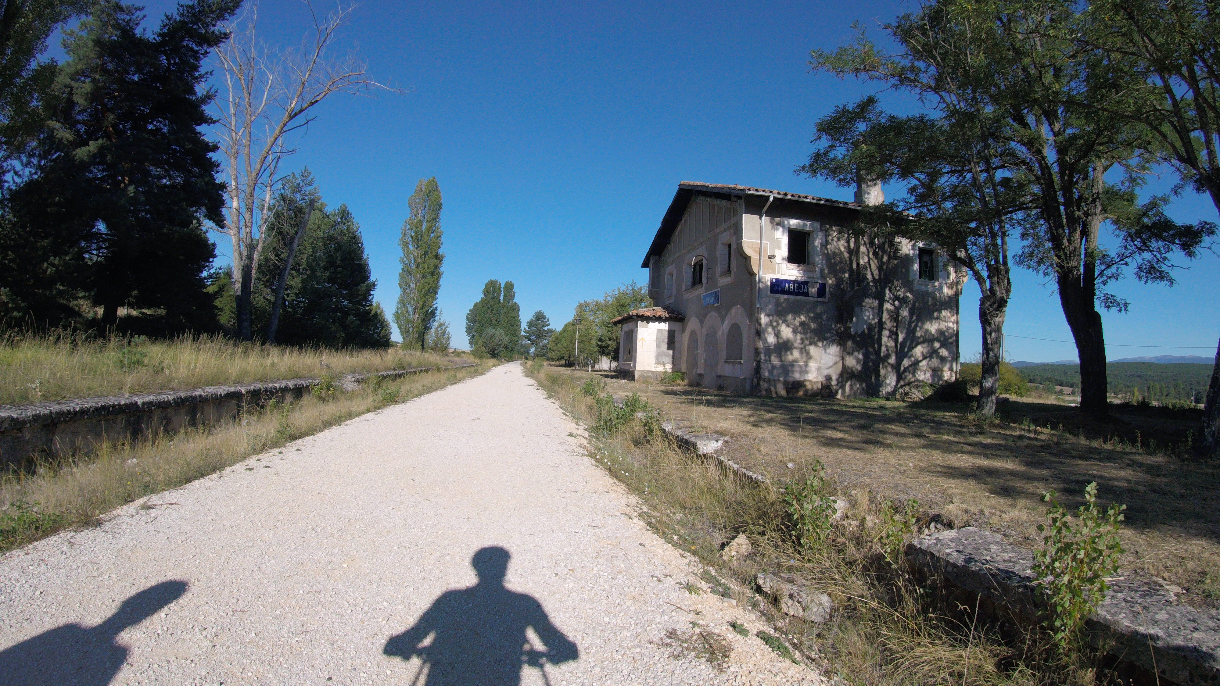
Another alternative, the one we take, is to go uphill a little further, to reach the Santander-Mediterranean greenway going down the north slope of the mountains.
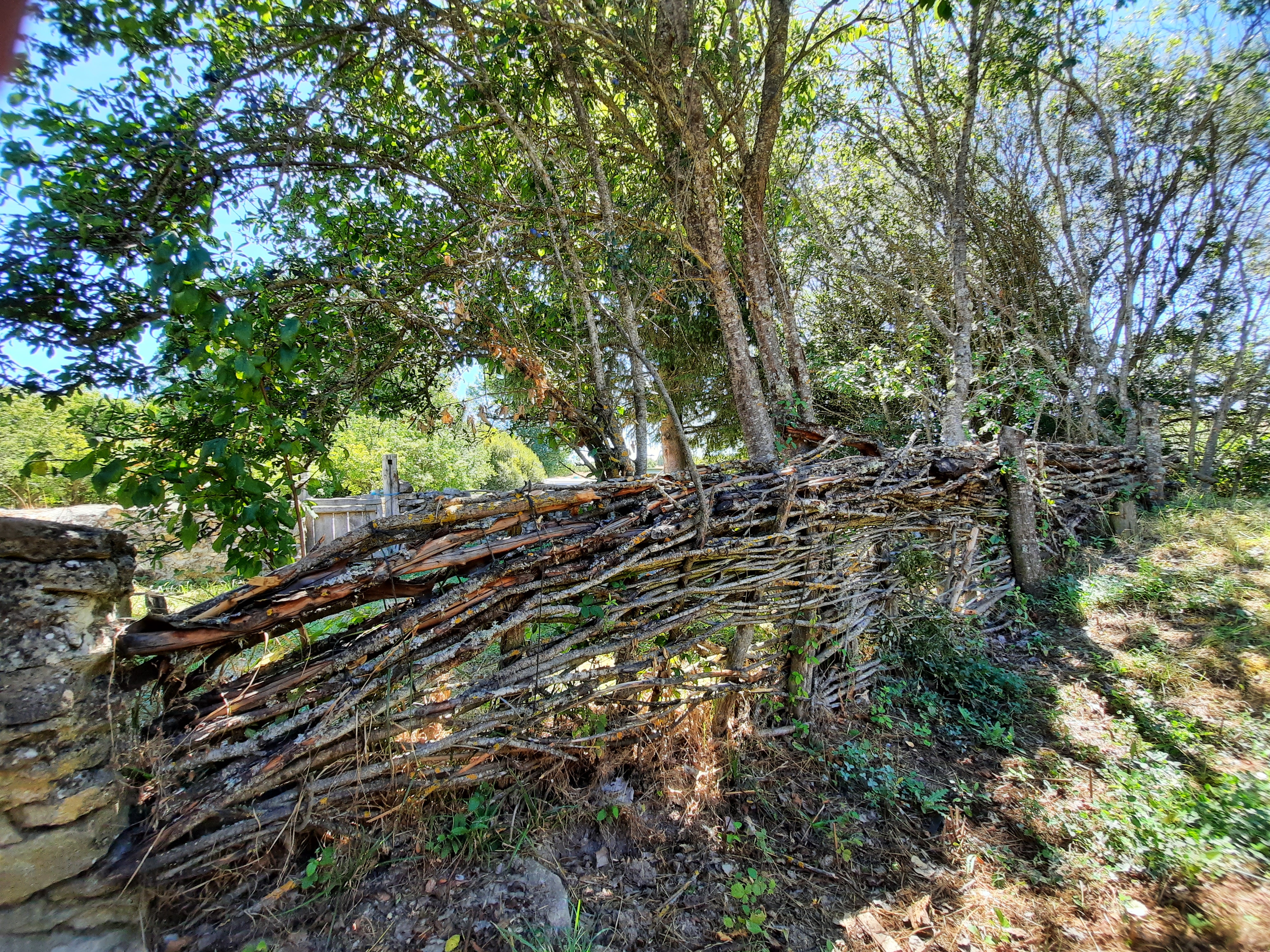
The descent is a bit technical, mainly because of the loose stones in some sections, but the views are spectacular. Just before the Green way, there’s a fence, that you have to open and leave closed after passing through.
Abejar


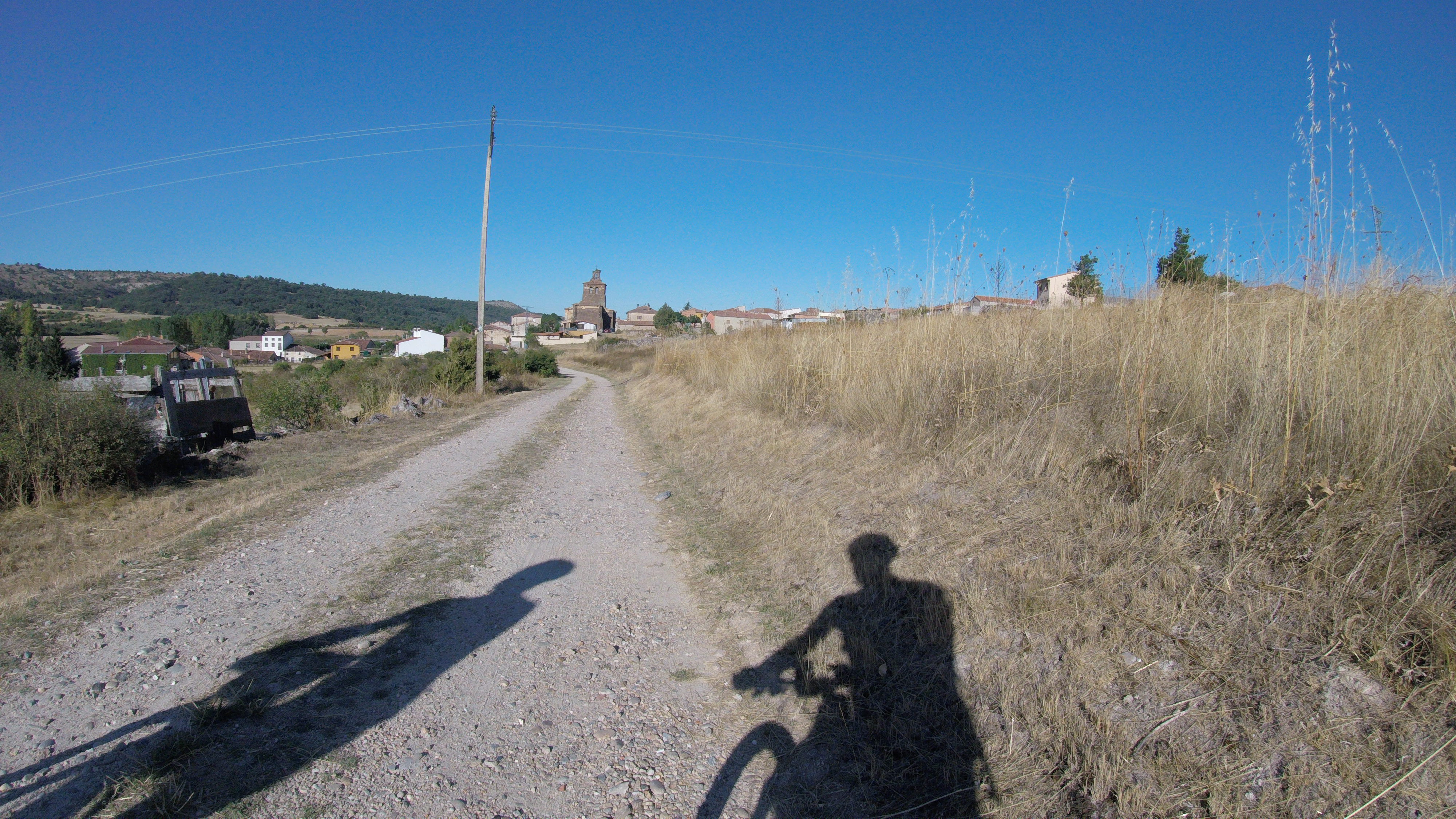
On the greenway, we connect with the road that goes down from the Sierra de Cabrejas, and we enter in Abejar, known as «The Gate of Pinares“ because of its strategic geographical location.
From here we access the upper Duero basin and most of the villages of the región of Pinares.
From an architectural point of view, in Abejar we can already find good examples of the typical pine houses, with their characteristic wooden balconies which I love.
The San Juan Bautista church, completely built in ashlar masonry stone, is the most prominent building in the village, and one of the most gothic temples representative of the province of Soria.
From Abejar, we continue on the greenway towards the west to Cabrejas del Pinar, in the hillsides of the Sierra de Cabrejas and its groves.
Cabrejas del Pinar

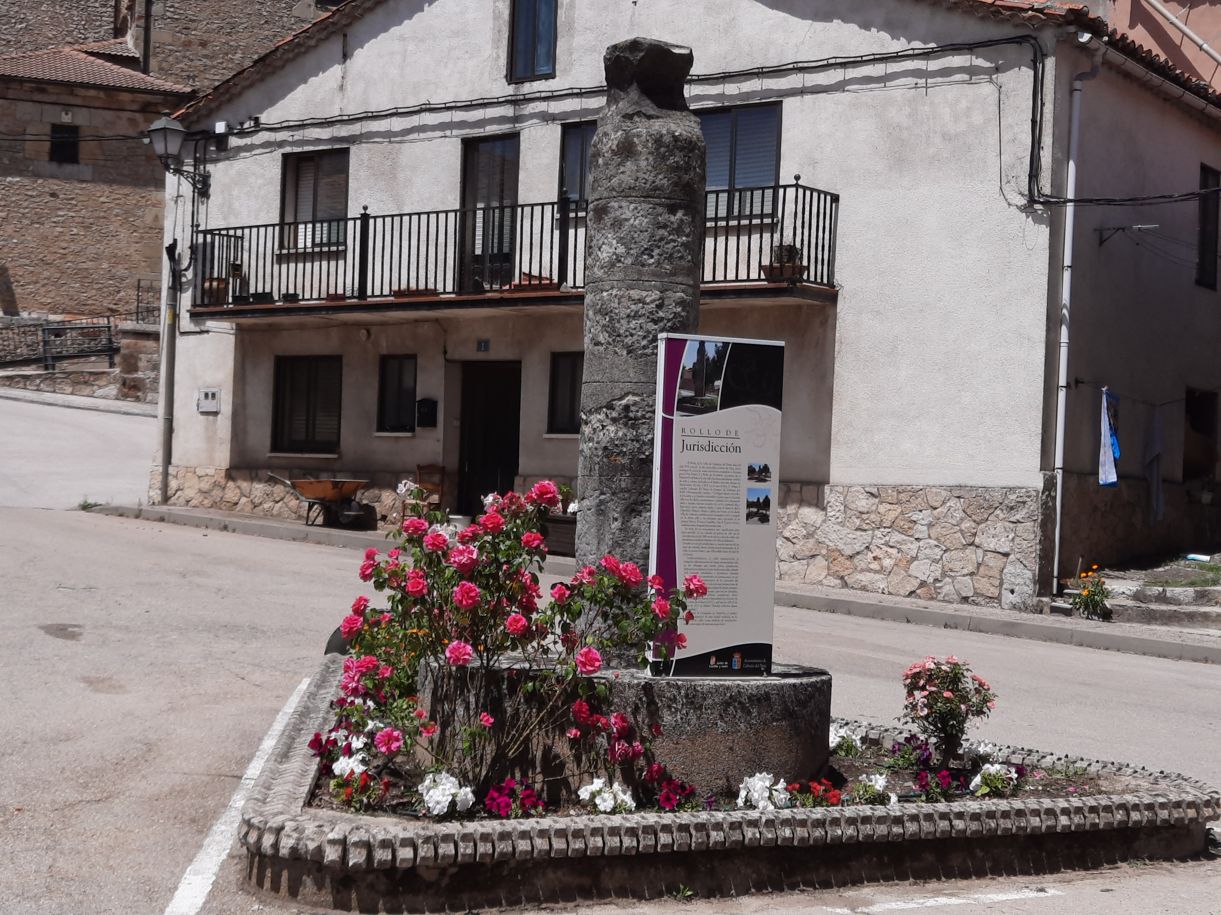

With a registered population of about 360 inhabitants, Cabrejas del Pinar, was the head of the Villa Community and Land of Cabrejas in the Middle Age.
From that period it still conserves its roll of justice.
Riding through its urban area, we can also recognize the typical architecture of this region.
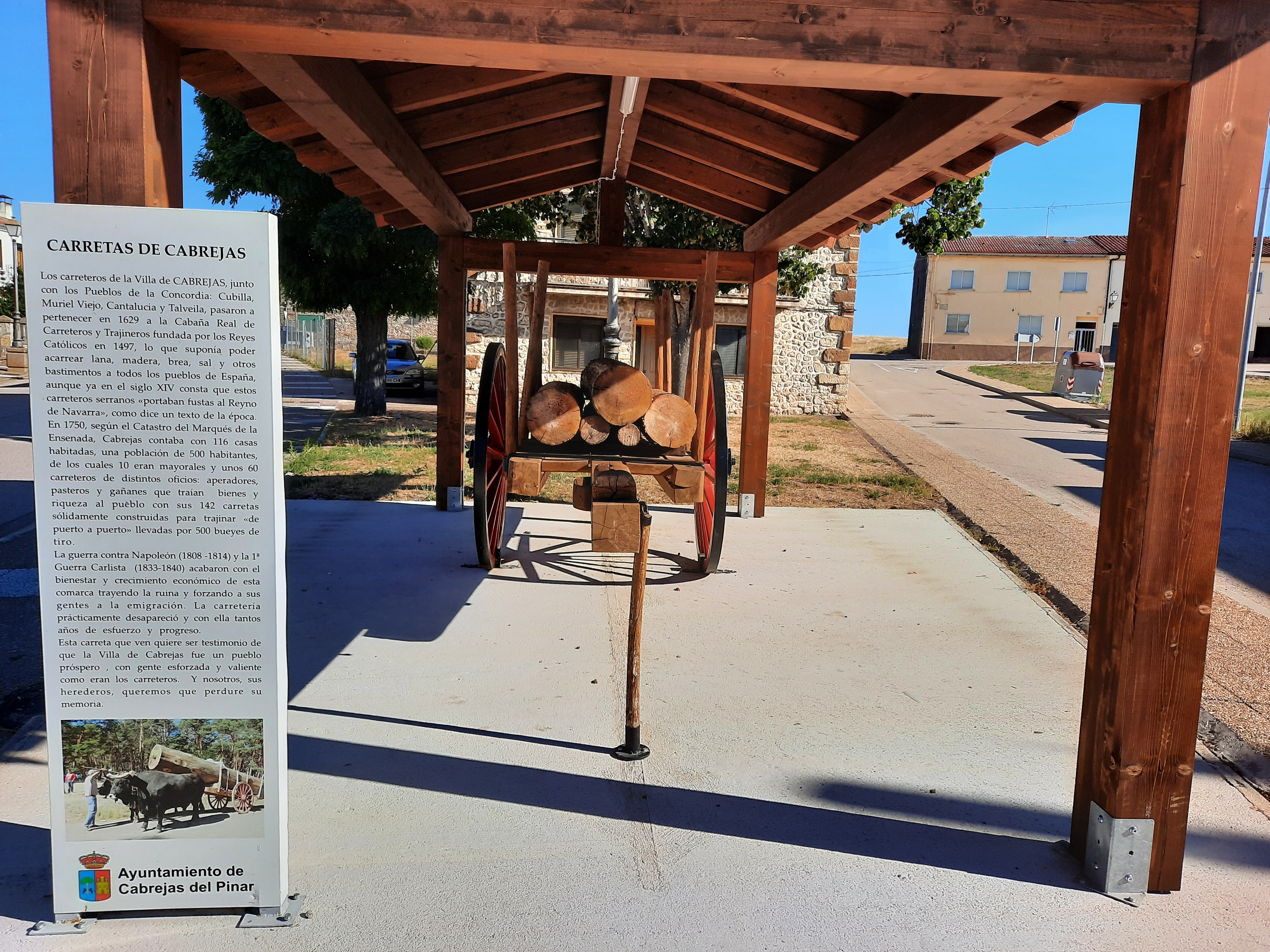
At the entrance of the village from Abejar, a monument to the wagons of Cabrejas, remember the time when this área integrated the Royal Cabin of Carreteros.
This institution founded by the Catholic Monarchs, was a very important impetus for the economy of this pine forest area between Burgos and Soria.
The Baroque-style church of San Millán and the ruins of the castle, at the top of the village, complete the most interesting parts of the town. And on rain periods, the Chorrón Waterfall, well deserves a visit as well. We can find it in the vicinity of Cabrejas, towards the south, by the road to Muriel de la Fuente.
We continue our route, now bordering the northern hillside of the Sierra de Cabrejas, to climb up to the top of the route, at an altitude of 1,332 m, close to the Mojón de La Lastra.
This will surely be the hardest part of our trip, with three kilometers of ascent and an average slope of 6%.
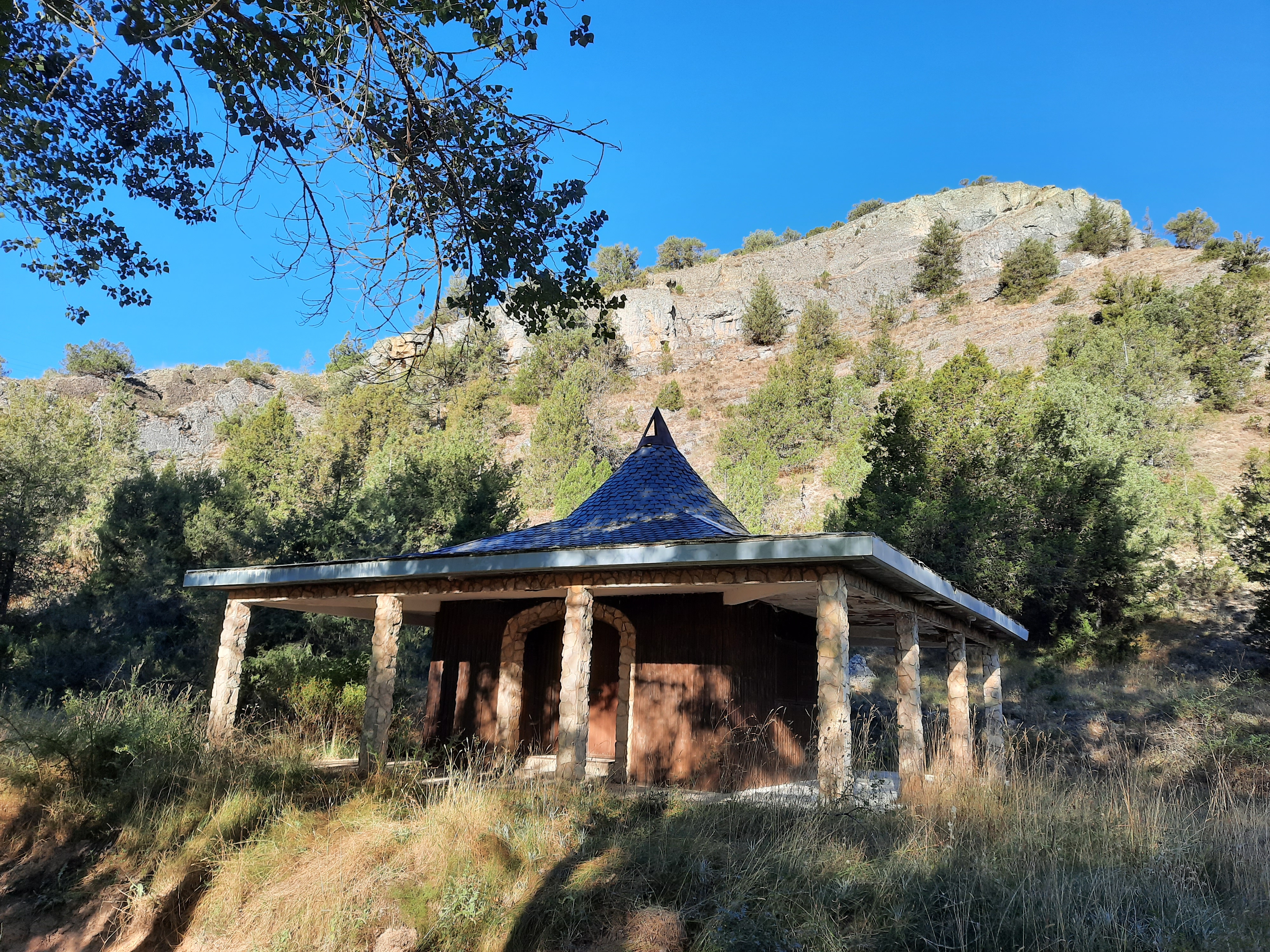
Now, almost all downhill, to La Peñota viewpoint. We can find some spars and loose stones , but with a little care we won´t have problems getting there.


The views are spectacular. There is also a small shelter here, which could be a perfect end to the day and enjoy the nightfall and also the sunrise the next day.
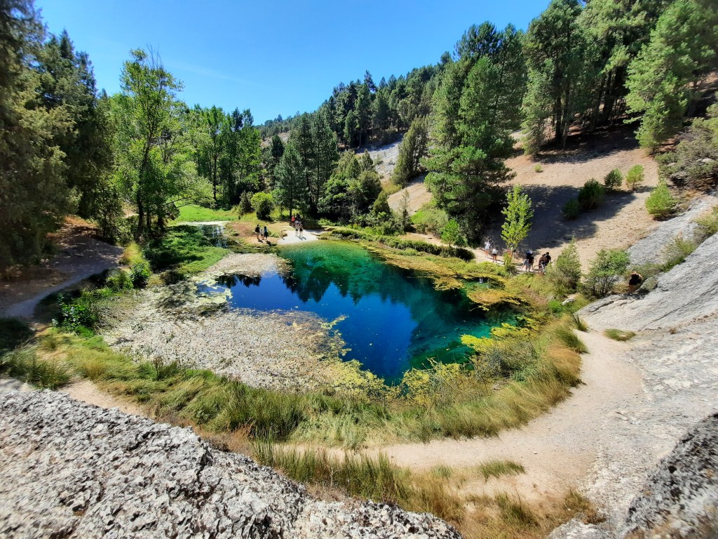
We return to the road to continue towards the Natural monument of La Fuentona, the source of the Abión River.
Passed a sheepfold, we follow the PR path, and arrive at the spring directly by the upper side with a stunning postcard. It´s a singletrack also with loose stones, where we have to ride through carefully.
The alternative to this section is to go down to Muriel de la Fuente, taking a dirt-road to our right before the sheepfold just mentioned.
Whether you arrive from one side or the other, La Fuentona is a unique place, always surrounded by the mystery of the depth of the cave from where the river flows.
La Fuentona
We leave La Fuentona and continue along the road from the outskirts of Muriel de la Fuente to Calatañazor, passing first through the Sabinar de Calatañazor Natural Reserve, a forest with some of the biggest and most ancient specimens of Thuriferous junipers in the Iberian Peninsula, one of them included in the register of unique trees of Castile and León.

Calatañazor juniper groves
Calatañazor


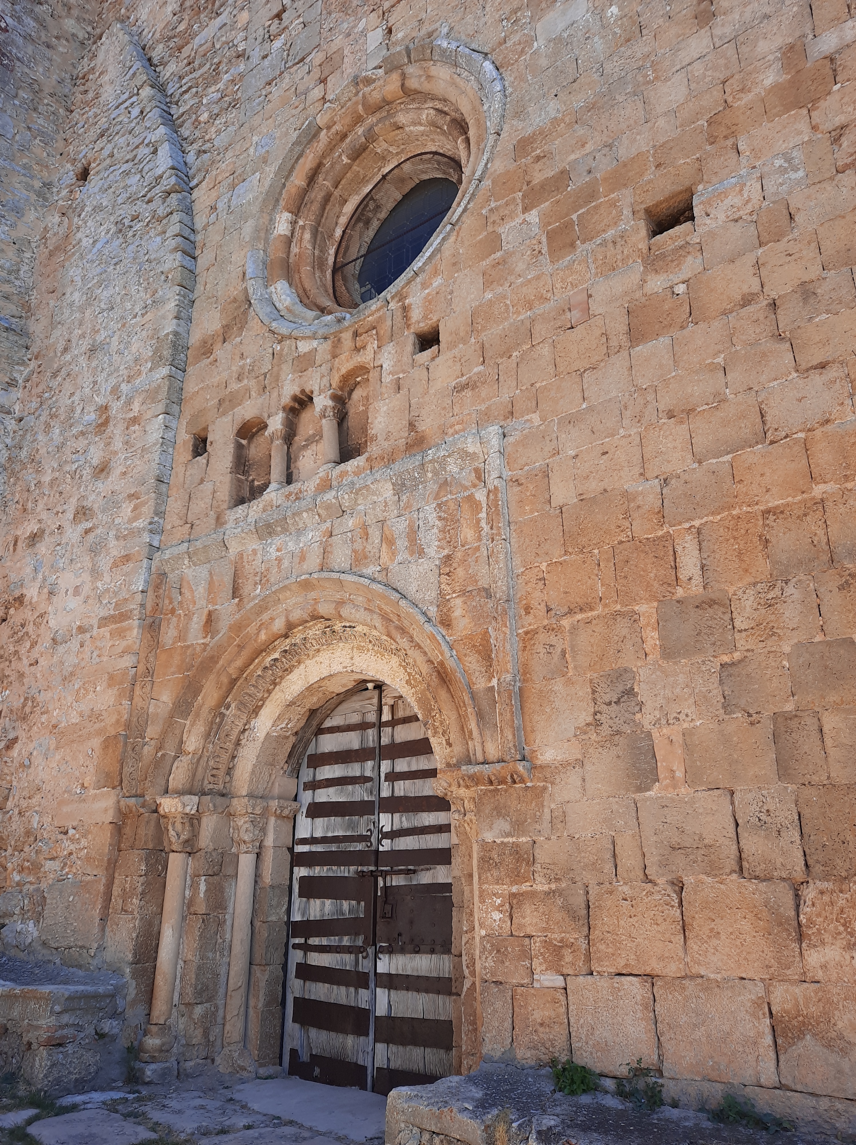
We arrive in Calatañazor, passing first through the San Juan Bautista ruined hermitage and afterwards the hermitage of the Soledad, both Romanesque.
Its name is attributed to the Arabic term «Qal’at nan Nusur», which translated, would be something like «castle of the eagles.
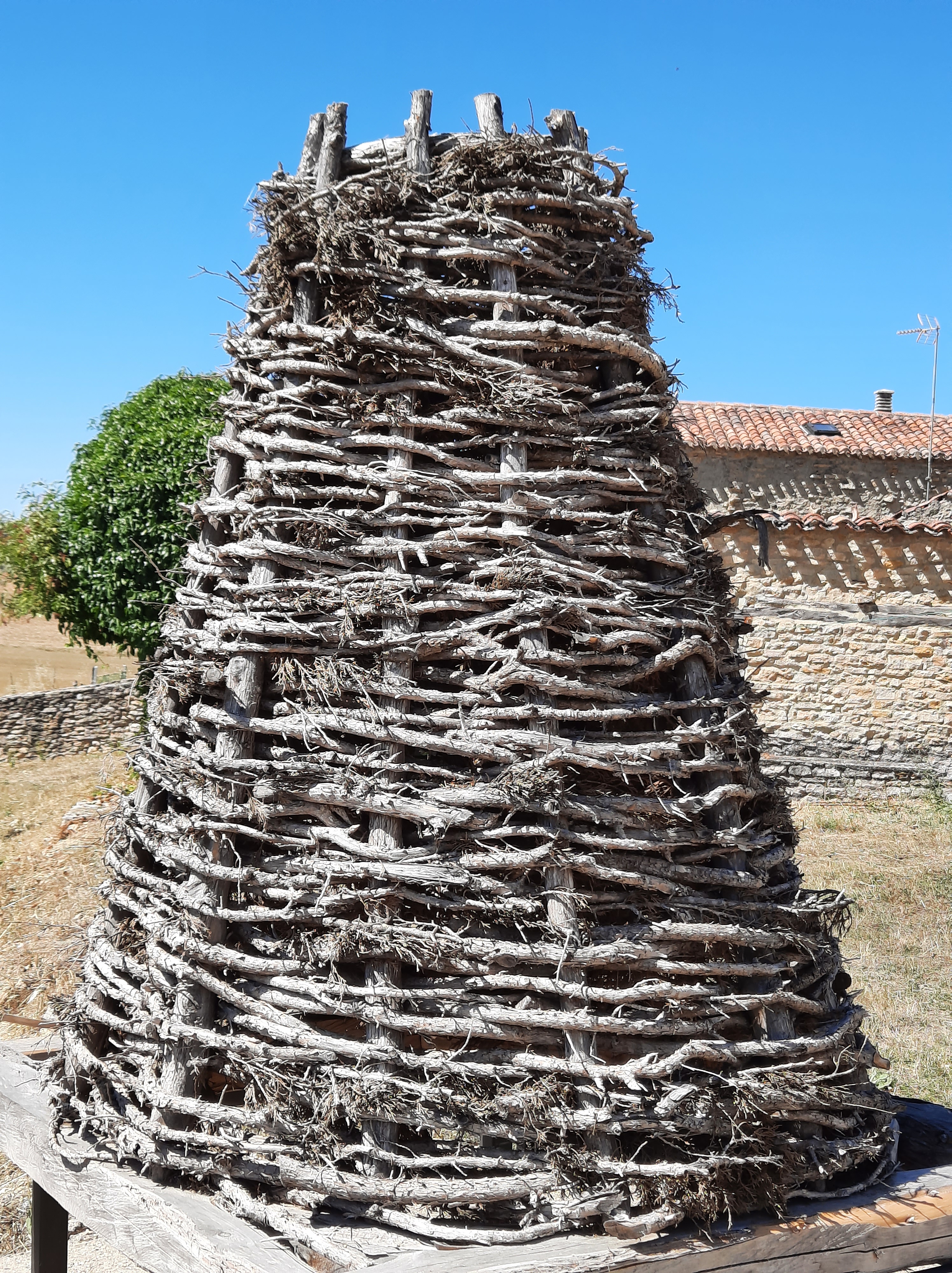
Going up Royal Street, the main artery of the town, we go back in time while pedaling. Typical streets and houses of stone, juniper wood, brick and mud, with its characteristic conical chimneys on the roofs, preserve the medieval atmosphere of this place.
We leave to our left the Church of Nuestra Señora del Castillo, a mixture of Romanesque and Gothic, and which houses a small parish museum.
At the end of the street, the Main Square and the castle, recently restored. From the top of the homage tower, almost surely with some vultures around us, the panoramic view is spectacular.
We see the layout of the wall, the canyon of the river Milanos to the east, and to the west the Blood Valley, where legends say that the Arabic warlord Almanzor was surprised and wounded to death.
We ride through the rest of the town centre, with an identical medieval aspect, and we can taste the typical local products in one of its bars, restaurants or shops.
Abioncillo de Calatañazor
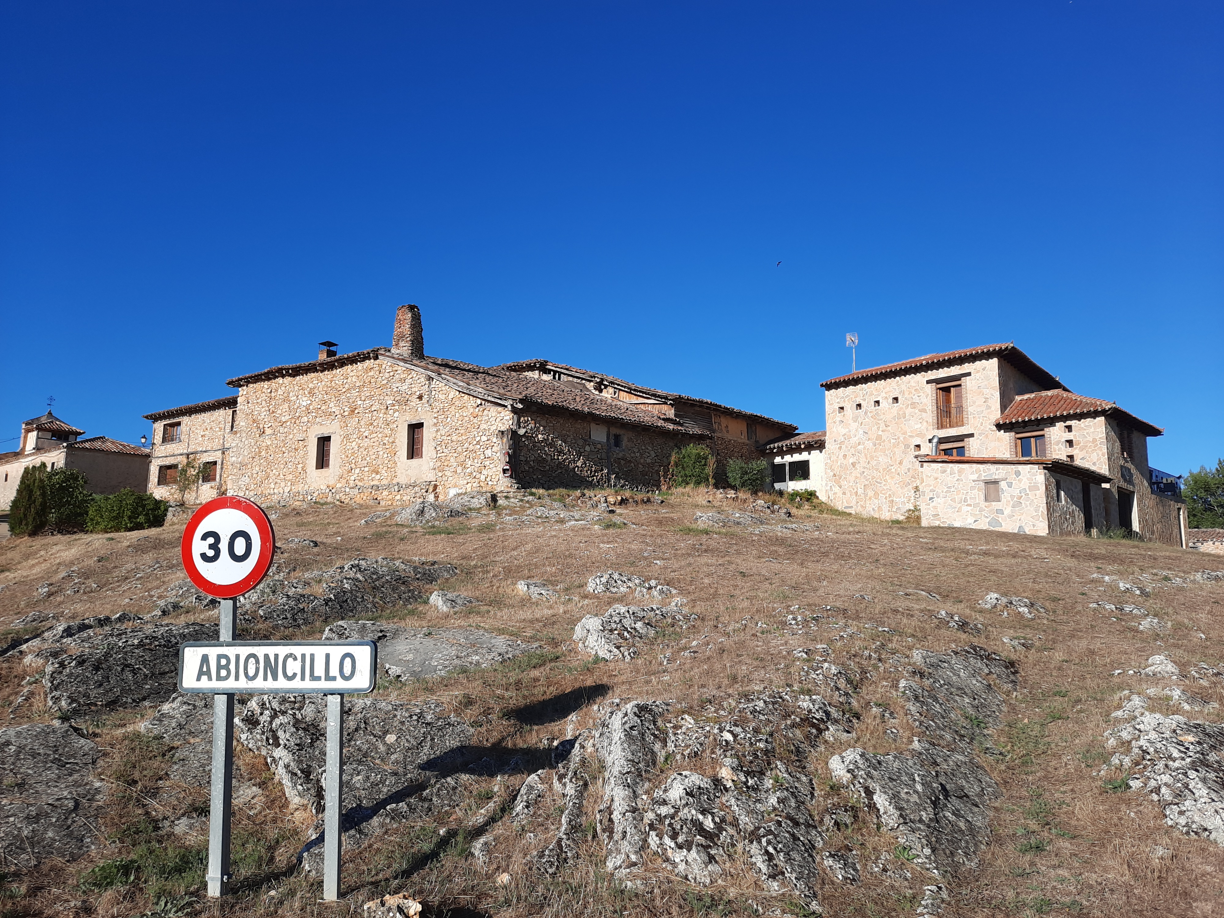

We leave Calatañazor on a single track passing under the castle (alternatively, we could also return to the road by going back along Royal street) and we arrive by road to Abioncillo de Calatañazor. This small village, is well conserved and it also maintains the structures so characteristic of this área.
A small meadow by the Abión River, but with good shade can be a perfect place to escape from the heat in the summer period.
After a demanding first stretch, with a good climb of approximately 1 Km, we leave the Sabinares de la Sierra de Cabrejas protected area at its southern end and we arrive on dirt-road to Blacos.
The Milanos river, which comes from Calatañazor,runs along this space, and if we deviate a kilometer to the northwest we come across the River Abión again, in a bucolic spot with the last refuge.
We continue to the west, leaving Blacos between the farming esplanades and the cemetery and we arrive in Torreblacos, just 2,5 Km far.
Nearby Torreblacos the rivers Milanos and Abión join together in their way to the Ucero river, 20 Km to the southwest.
These two rivers, Milanos and Abión, are also protected by the Natura 2000 Network, within the natural area called Duero river banks and tributaries.
We cross the N-122motorway and we continue until Rioseco de Soria on the SO-P-4046 road, quiet and with good asphalt.
The landscape becomes rougher on these moors and the earth becomes reddish, though we’ll also find holm oaks and junipers around here.
Rioseco de Soria
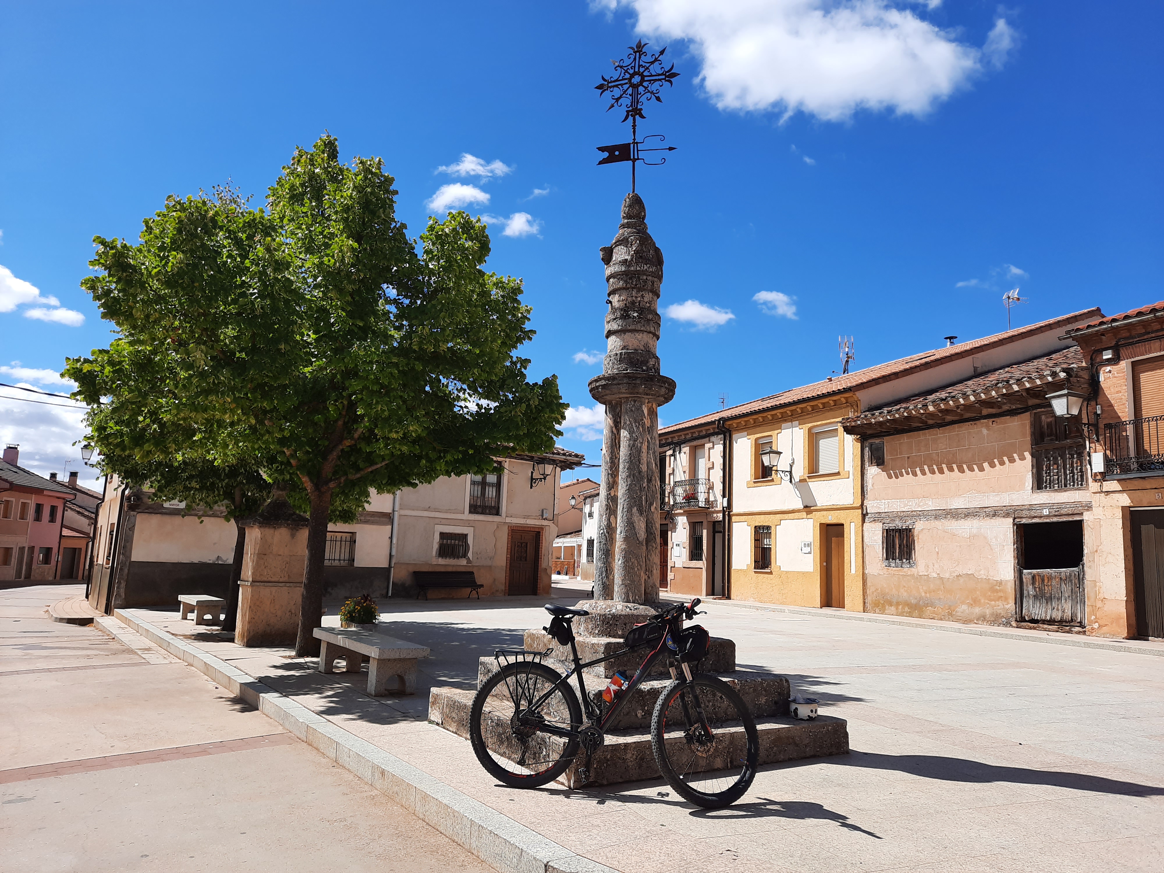


In Rioseco’s Main Square, it´s curious its roll of justice, interesting due to its marble column, which comes from the Roman villa Los Quintanares, at the south of the village, next to the road to Andaluz.
From the Roman villa, we can only appreciate its forms, as it´s awaiting funds to discover the amount of mosaics that are kept there.
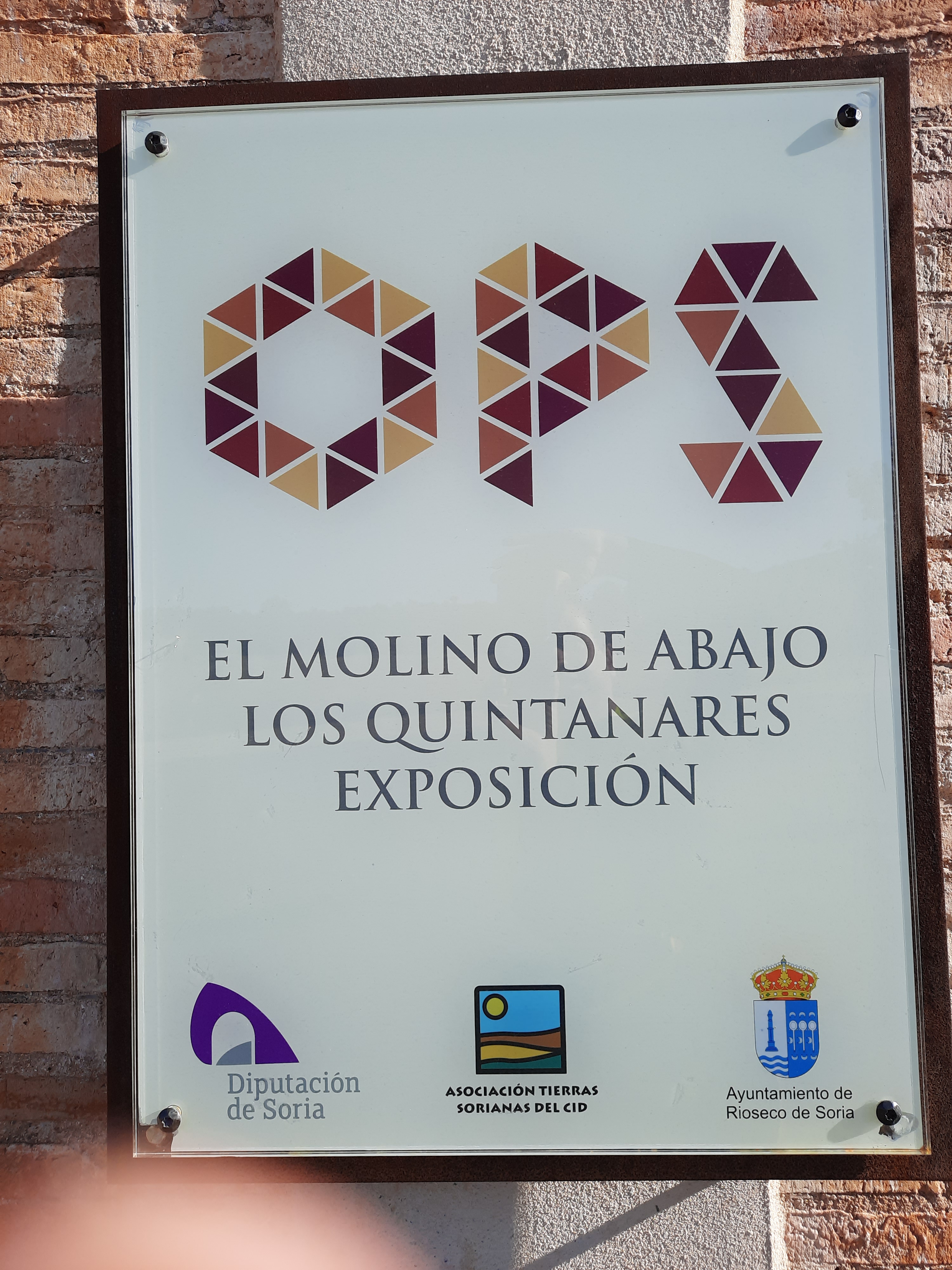
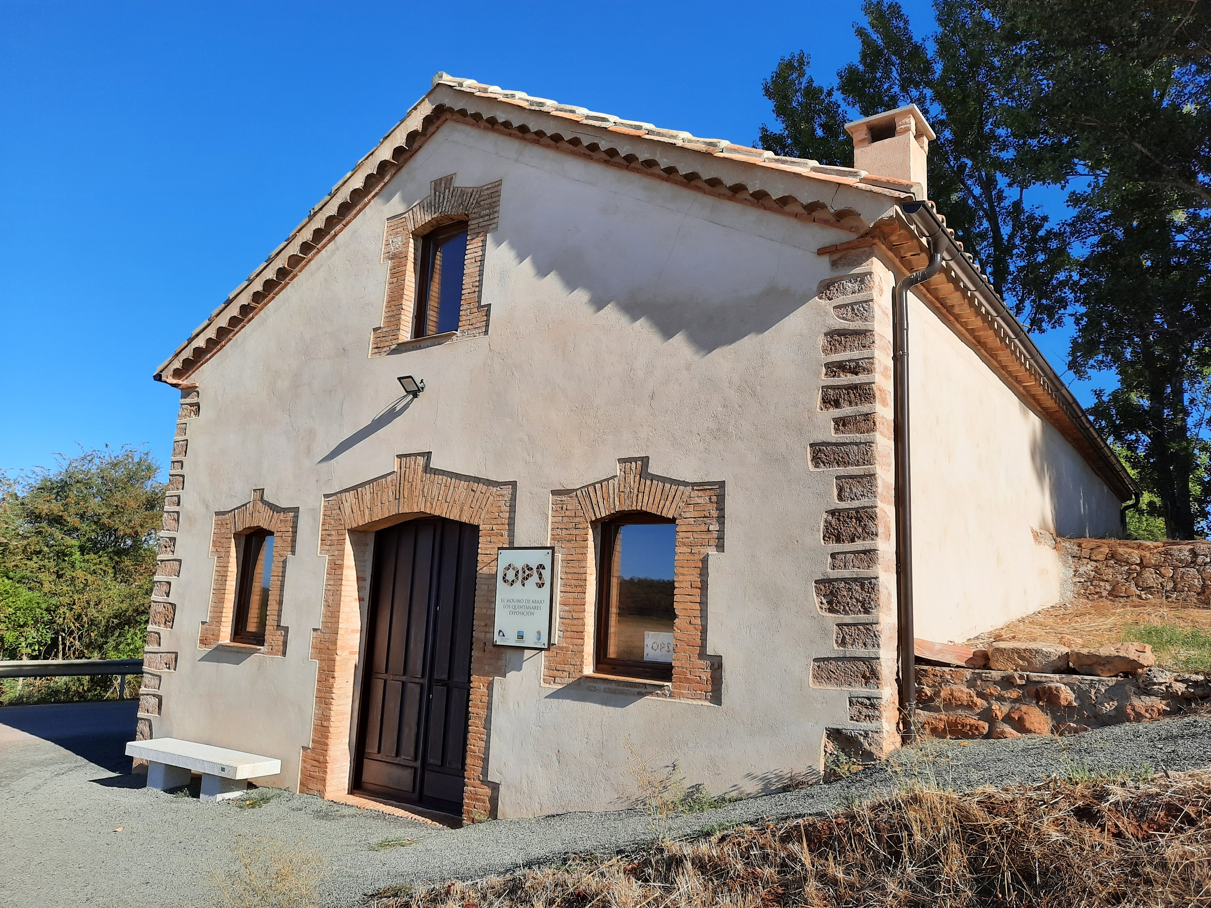
Across the road, in front of the Roman villa, we find the OPS cultural centre, a renovated old mill.
The entrance is dedicated to the mill and the first floor to the Roman villa.
From Rioseco, we continue to Valderrodilla by dirtroad, and arrive at Andaluz between pines and crops, a lovely and quiet freshly paved road.
Andaluz

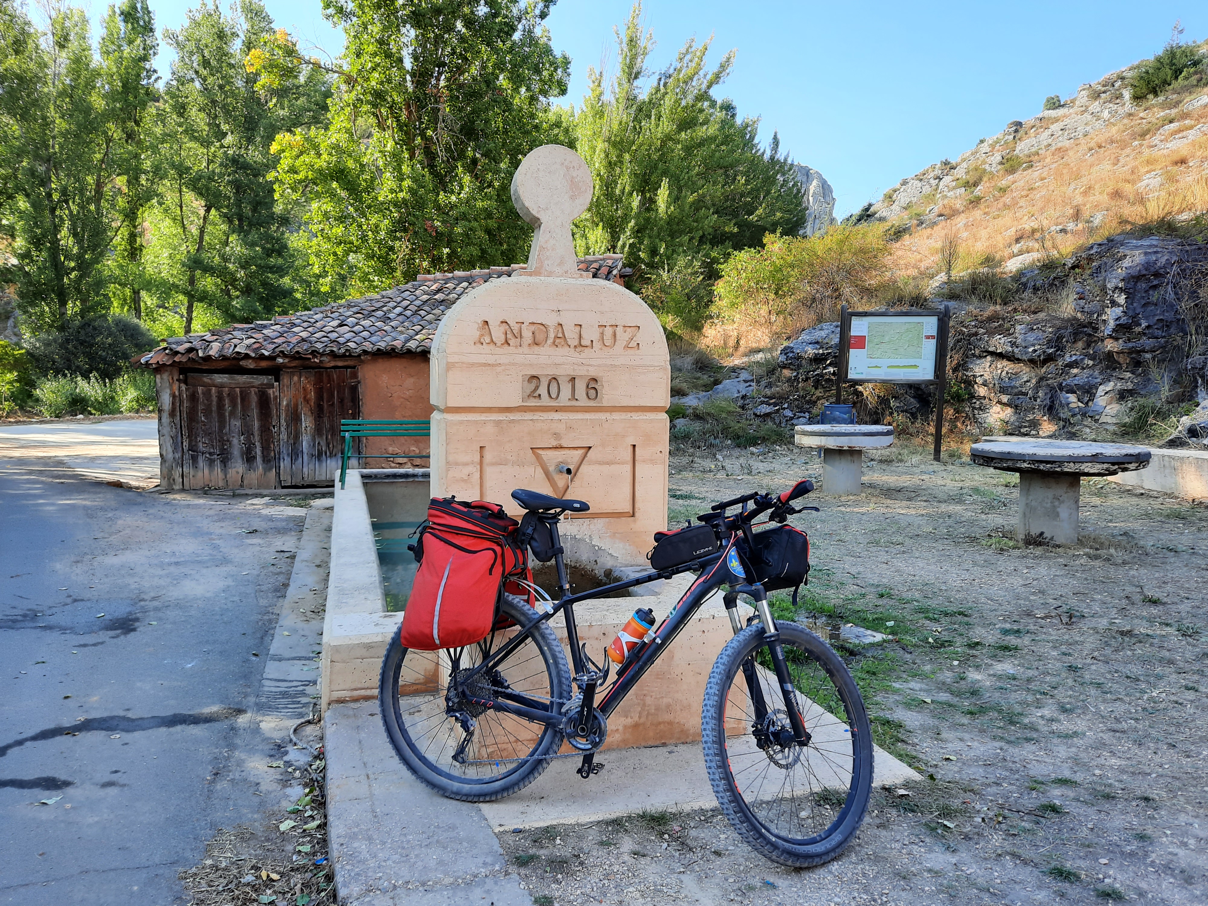


In front of us, just before we reach Andaluz, the river forms a beautiful canyon, cutting the mountain range in two and with vultures flying over our heads or resting on the rocks.
The St Miguel Arcángel church, with a beautiful Romanesque portico , is the most significant building in the village.
We plunge into the last few kilometres of our journey back to Almazán, following the Senda del Duero natural path.
We still have one last surprise, just over a kilometer from Andaluz, to enjoy the spectacular views from a viewpoint next to the Duero.
We arrive in Almazán from the west, following the Duero, through the park of La Arboleda.
Cruzamos la pasarela sobre el río, hasta el Rollo de las Monjas, y callejeando un poco por el casco histórico, terminamos la ruta en la Plaza Mayor, disfrutando de su entorno monumental y sus vistas al Duero.
We cross the pedestrian bridge over the river, up to the Rollo de las Monjas and the medieval walls, and wandering a little down the historical centre, we finish the route in the Main Square, enjoying its monumental surroundings and its views of the Duero.


Hotel Villa de Almazán
Tfn.: +34 975 300 611 email: recepcion@hotelvilladealmazan.com

_______________
Guest House Tirso de Molina
Tfn.: +34 975 300 416

_______________
Guest house Plaza Mayor
Tfn.: 975 300 064 email: hostalplazamayor@hotmail.es


Hotel La Barrosa
Tfn.: +34 609 137 525 email: hotellabarrosa@gmail.com

_______________
Hostel Cañada Real
Tfn.: +34 975 373 297 email: alberguedeabejar@gmail.com

_______________
Campsite El Concurso
Tfn.: +34 975 373 361/+34 975 373 396 email: info@campingelconcurso.com

_______________
Campsite Urbión
Tfn.: +34 646 243 349/+34 975 231 630 email: info@campingurbion.com


Rural Hotel Quintanares
Tfn.: +34 975 365 936 email: reservas@quintanares.es


Coordinates: 41.76259, -2.90078
Bars & restaurants can be found in Almazán, Tardelcuende, Quitanta Redonda, Abejar, Cabrejas del Pinar, La Fuentona (Muriel de la Fuente), Calatañazor and Rioseco de Soria.
Take the chance to enjoy the delicious torreznos and other local dishes.

Different suppermarkets and grocery stores in Almazán, Tardelcuende, Quintana Redonda, Abejar, Cabrejas del Pinar, Calatañazor or Rioseco de Soria.
Also possible to find ambulant grocery sales, specially during summer.
If some repair is needed in this route, it´s only possible in Almazán, where also hardware products can be found.
For more alternatives, the city of Soria is 36km far from Almazán.
Bicyle shops, repairs, rental and transfers, can be found in the resource map.
Better not to need it, but if necessary, there are pharmacies in Almazán, Tardelcuende, Quintana Redonda, Abejar, Cabrejas del Pinar and Rioseco de Soria.
Opening hours can differ between them, you can check in the resource map.